A- A+

LOCATION OF AUSCHWITZ CONCENTRATION CAMP

ESCAPES FROM AUSCHWITZ

ESCAPES FROM AUSCHWITZ

LOCATION OF AUSCHWITZ CONCENTRATION CAMP

In October 1939, after Poland was defeated, western territories of the country were incorporated by the Germans into the Third Reich, while central territories were transformed into so-called General Government. In November, eastern territories were incorporated by the Soviet Union. 

illustration

Division of Poland in 1939. Western territories were incorporated into the Third Reich, central ones transformed by German authorities into the General Government, while eastern incorporated by the Soviet Union. The city of Oświęcim (German: Auschwitz) became part of the Reich.

Graphic design: Elżbieta Pietruczuk 

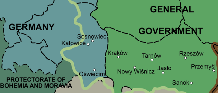
The city of Oświęcim (Auschwitz) was located within the territory annexed to the Reich. According to the new administrative division, it became part of the Bielsko district (Kreis Bielitz) in Katowice region (Regierungsbezirk Kattowitz), Silesian province (Provinz Schlesien). As the territories incorporated into the Reich were supposed to undergo Germanization, the Polish name of the city was replaced with the German one—Auschwitz. The same name received a concentration camp created by the Germans on the outskirts of Oświęcim in the spring of 1940.


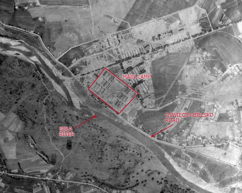
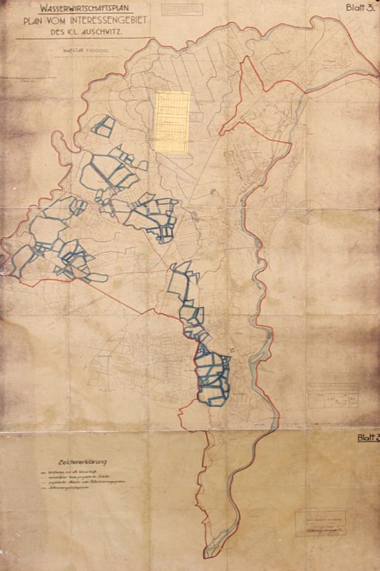
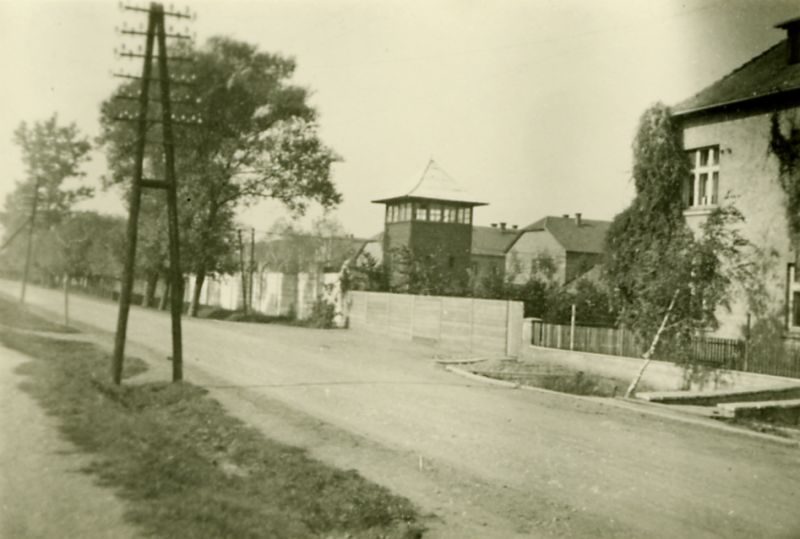
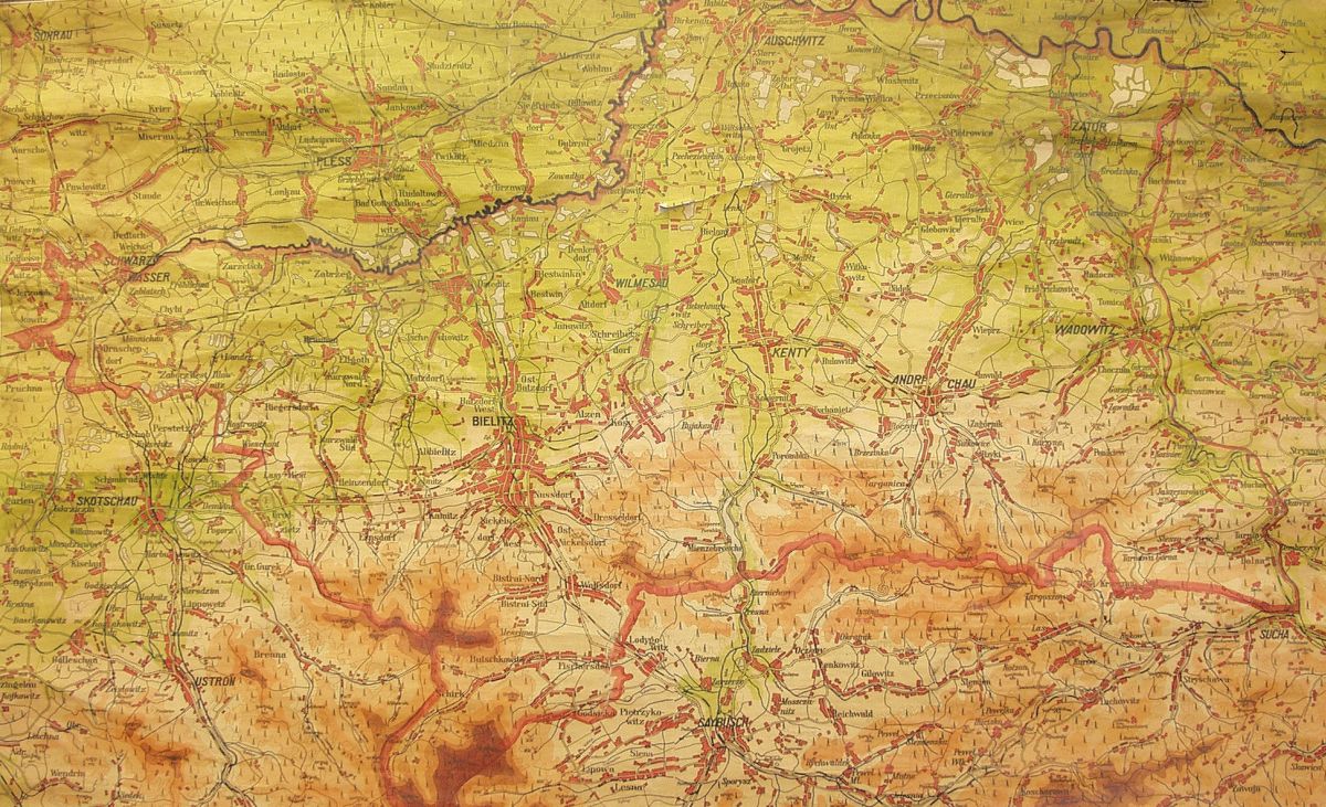
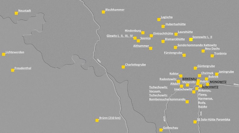
The concentration camp (German: Konzentrationslager—KL) Auschwitz was located on the outskirts of the city, near the road leading from the city centre through Brzeszcze to Bielsko and Pszczyna. Following the expulsion of Polish and Jewish residents from the territories located in the vicinity of the camp as well as from eight villages located to the west of Oświęcim, German authorities created in 1941 the so-called Auschwitz interest zone (Interessengebiet des Auschwitz) embracing the territory of approx. 40 sq km. The western and northern borders of the zone were marked by the Vistula river, eastern by the river Soła, while southern as well as south-eastern border ran along the roads, dikes and creeks crossing the villages of Brzeszcze, Przecieszyn, Jawiszowice and Zasole (Łęki-Zasole at the time). Within the zone, Birkenau camp was created (on the fields of the village of Brzezinka, the inhabitants of which had been expelled) along with several agricultural and livestock farming sub-camps. The entire area was patrolled by the SS men, and the Poles residing nearby 

could only move on designated roads.

The occupation authorities expulsed also a significant number of Poles from the territories located to the east of the Soła river, in the strip of land between Kęty and Zator, introducing instead German colonists there. When prisoners escaped from Auschwitz, the colonists would cooperate with the SS men searching for them. In the north-eastern part of the area, in the vicinity of the villages Monowice and Dwory, German conglomerate IG Farben was constructing a chemical plant, near which SS authorities created the third camp of the Auschwitz complex—Monowitz.


The area adjacent to the Auschwitz camp was flat, without many forests and additionally, there were streams supplying water to numerous breeding ponds. All these conditions made it more difficult for prisoners to escape. Vast forest areas were located a few to a dozen kilometres to the west of the camp (so-called Pszczyna forests) and at a similar distance to the north and north-east (near Chełmek, Jaworzno, and Chrzanów), as well as further to the east towards the city of Cracow. Especially the latter could serve as a shelter for camp escapees. A large forest complex was also located about 25 km to the south from Auschwitz (Bielsko–Andrychów–Żywiec region). These forests grew on the slopes of the Beskidy Mountains, visible from the camp (especially from Birkenau), towards which some of the escapees headed after leaving the camp.  

illustration

German map of the Bielsko district (Kreis Bielitz) during occupation. District borders are marked by a red line, the city of Oświęcim (Auschwitz) was in its northern part, while in the south there were the Beskidy Mountains slopes with forests. Large forest complexes were also located to the west and north-east of Oświęcim. Eastern border of the district (behind Zator and Wadowice [Wadowitz]) constituted at the same time the border of the Reich and the General Government.

Source: A-BSMA

Auschwitz was located within the borders of the Reich, which was a favourable condition for escapes undertaken by the Germans (usually criminal or so-called asocial prisoners). In addition, it was located nearly 70 km from the Slovakian border (direct distance) and over 70 km from the border with the then Protectorate of Bohemia and Moravia. Probably the proximity of borders influenced the decision to escape taken by Czech prisoners, Czech Roma, or Slovakian Jews.


About 25 km to the east from the camp there was the border of the Reich and the General Government—administrative unit managed and controlled by German administration and police. However, unlike to the Polish territories incorporated into the Reich, occupational authorities left there some elements of the Polish State structures, among others the police subordinated to German order police (Ordnungspolizei), schools and low-level administration, as well as some organizations. Thus, the system of controlling the Polish society was slightly less strict than in the Reich. That is why numerous Polish prisoners, while deciding to escape from the camp, hoped to find a good shelter in this area. Reaching the General Government (or the already mentioned Beskidy Mountains) was facilitated by the attitude of a great number of Poles residing near Auschwitz. In spite of the threat of losing their lives and freedom, they helped the escapees by providing shelter, giving directions and accompanying while crossing the border. Some of them organized the escapes themselves or helped in their coordination. 

Map of the southern part of territories incorporated into the Reich. Oświęcim (Auschwitz) was located relatively near the General Government, Slovakia and the Protectorate of Bohemia and Moravia. 

illustration

Auschwitz camp complex included also nearly 50 sub-camps, located mainly near industrial plants and coal mines in Upper Silesia as well as Western Lesser Poland. The territories were highly urbanized and populated with a dense network of roads and railway lines, which facilitated the escapes of prisoners. The Poles, who lived and worked in the region frequently helped them.  

The map of Auschwitz sub-camps located mainly in the Western Lesser Poland and Upper Silesia. 

illustration

Graphic design: Robert Płaczek